Rock Carvings on the North York Moors
Moorsholm Rigg - Moorsholm
Moorsholm Rigg is a low ridge located on the
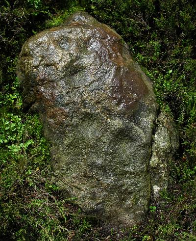
moorland to the west of Dimmingdale Farm. A small cup marked stone is
located on the eastern edge of the Rigg, just 500m to the west of the
Dimmingdale barrow site.
This low flat stone has 5 eroded cupmarks on its upper
surface plus a better
preserved cupmark was also noted under the moss covering the southern
end of the stone. The stone appears to be the only visible exposed rock
on this part of the moor and at first glance the stone seems rather isolated
and insignificant, presenting something of a puzzle as to why it was selected for cup marking.
However, once again (as at the Dimmingdale barrow) the distinctive feature
of Freebrough Hill just 500m to the north is likely to
have been a factor in its selection.
A second factor could be the presence of an oval shaped
earthwork located 65m to the south of the carved rock. A low earth and stone bank
forms an oval
enclosure (30m x 10m) which has been identified as an enclosed
cremation cemetery, dating to the Neolithic/bronze age period.
It is interesting to note that when viewed from the southeast corner of
this enclosure,
the cup marked stone is in line with Freebrough Hill (see photo
below).
The actual axis of the enclosure points a little further to the north towards Warsett Hill on the coast, where a group of seven burial mounds were excavated in the early 1900's.
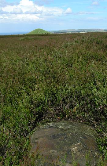
Top of Freeborough Hill viewed from the cupmarked
stone
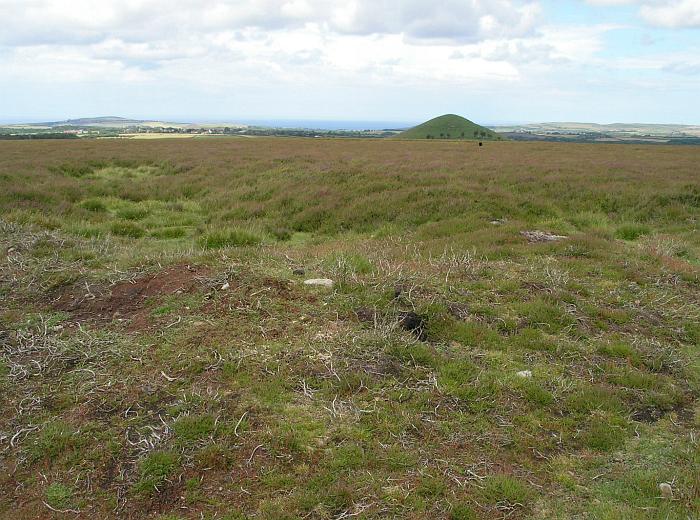
Photo of low bank around enclosure with Warsett Hill in the
distance (top left)
Black dot (a rucksack) in front of Freebrough Hill marks position of
cup marked stone.